


A resident walking along the stream and La‘i Road mentioned that the water is at only 50 percent of the level from decades ago. I can see why the residents somewhere around here fought against the plan to build a basin (reservoir?) as a flood-control mechanism. It would change the area drastically. Maybe if they built it way, way back near the mountain, but as the engineers drew it up, the plan would have wiped out four homes. It was scrapped later.
The area is pristine, dotted here and there with homes. It's one of the perfect blends of nature and humans. I didn't go any further (private road). There was no view of Pukele Stream from the road, anyway, but one day I'd love to get into the foliage behind the road. There's an incredible amount of valley and stream(s) off the grid.
The two stream-based memories that linger were near and far. Walking to high school each day, I often stopped at the Date Street bridge over Manoa-Palolo Stream (Drainage Canal). Back then, in the early 1980s, there were large, long and colorful trees hanging over the water. It was quite a stunning sight, particularly in the urban sprawl of nearby Waikiki, Kapahulu and Mo‘ili‘ili.
Further back in time, there was a hike deep in Hauula at a camp. At the end of the hike, we all drank from the stream. Cold water. Clean water. That was in the '70s, and nobody drinks the water anymore because of various, potentially fatal bacteria. But those were different times.
These journeys began with walks. Just getting some exercise. Then the bridges and photos and thinking about where the source of all our streams are. Like Makiki and Manoa, my interest in Palolo Stream began at its exit into the Ala Wai Canal. I went backwards until I got to Wai‘oma‘o at the back of 10th Ave. (and 10th Avenue Place), and up the hill on La‘i Road for a look at Pukele Stream. There's much more deeper into the valley, but that's for another time.
The effect of Pukele and Wai‘oma‘o is potentially powerful. The feasibility study. The flood mitigation project. The serenity of the place. Pukele is the stream that concerns the US Army Corps of Engineers, but when residents fought back against potential changes, the notion of building a basin there was dropped. The main priority is with mitigation efforts at Waihi Stream in Manoa, another cherished waterway.
Pukele Stream, La‘i Road


Pukele Stream, Palolo Ave. (mauka area)


Wai‘oma‘o Stream, 10th Avenue Place


Wai‘oma‘o Stream, 10th Ave.


Pukele Stream, Ahe St.
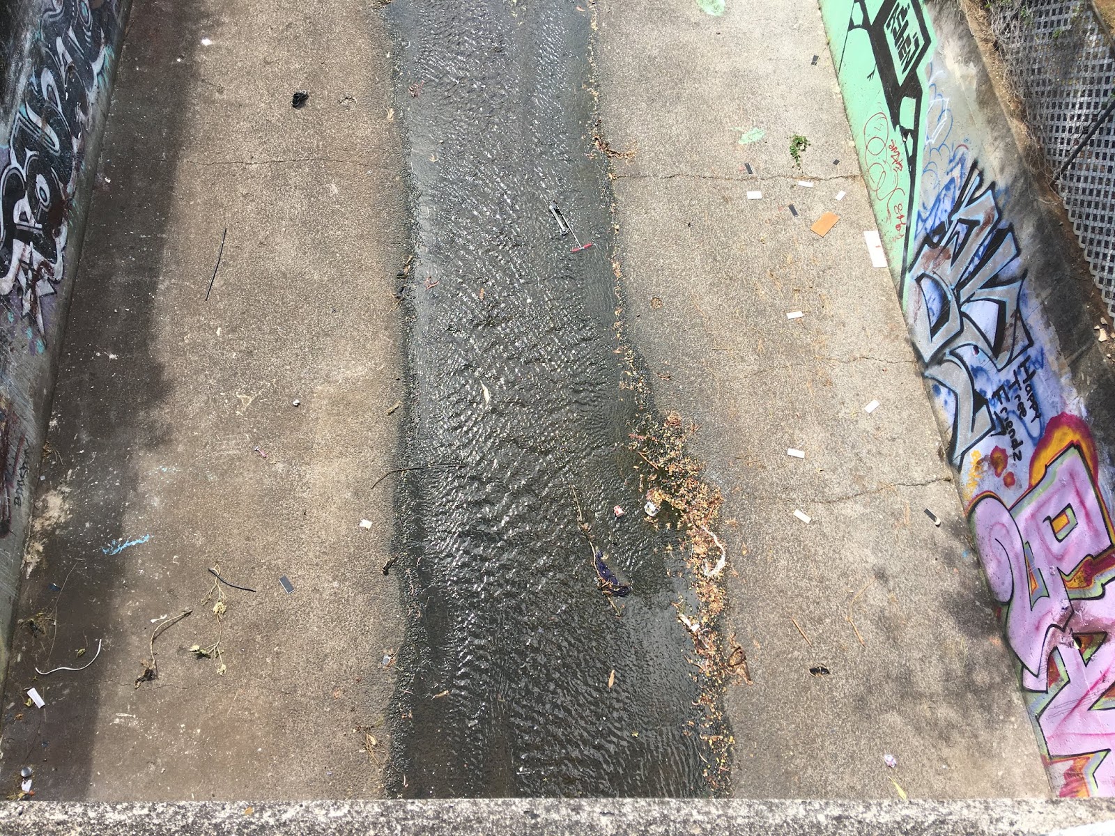
The stream ambles between residential homes and Anuenue School, slices diagonally through Palolo Valley Homes. Just beyond, Pukele Stream meets Wai‘oma‘o between the homes and Palolo Elementary School, forming Palolo Stream. Normally, an all-concrete waterway is considered a ditch or drainage canal. Ditches and drainage canals sometimes alter the natural course of water, but until I see a map that proves the stream had another location, this makes sense.
This map was drawn by a student at the University of Hawaii.


Palolo Stream, Kiwila St.
Like Pawaina St. bridge over Manoa Stream, this bridge is fairly high and the width of the path is wide. Palolo Fire Station and Palolo Valley District Park are next to the stream.


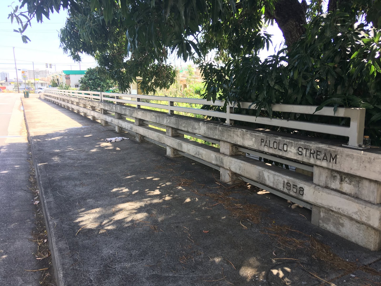
Pukele and Wai‘oma‘o Streams connect above Kiwila Street to form Palolo Stream.
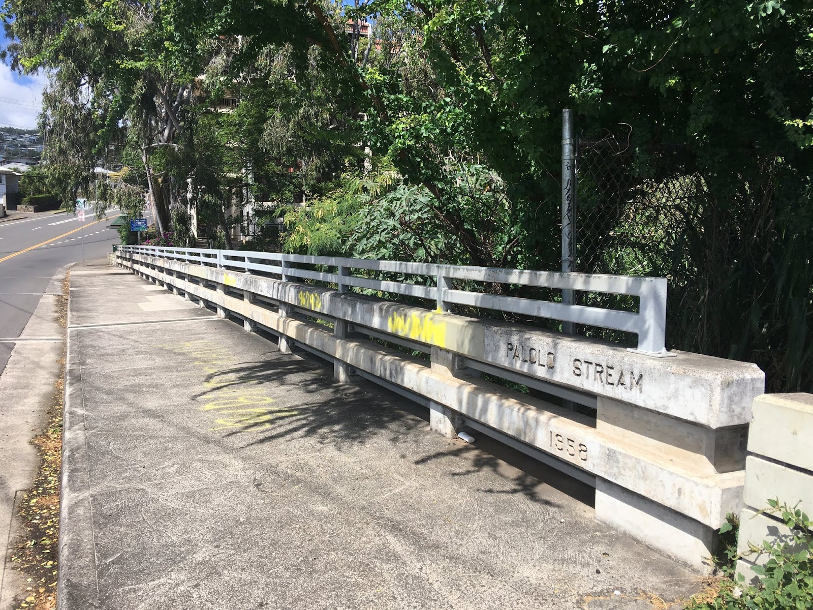
Palolo Stream, Kalua Rd.


Palolo Stream, Paalea St.
Interesting. One block east, Pukele St. It only goes for a few blocks, but the street runs parallel to Palolo Stream. Maybe there's a map from 1900 or so that can tell us whether it was Pukele Stream here before the man-made ditch was created. On those old maps, Pukele/Palolo Stream became Pahoa Stream as it veered into Kapahulu area.


Palolo Stream, Palolo Ave. (makai area)


Palolo Stream, 3rd Ave.
At the foot of Saint Louis School and Chaminade University.


Palolo Stream, St. Louis Drive


Palolo Stream, Koali Rd.
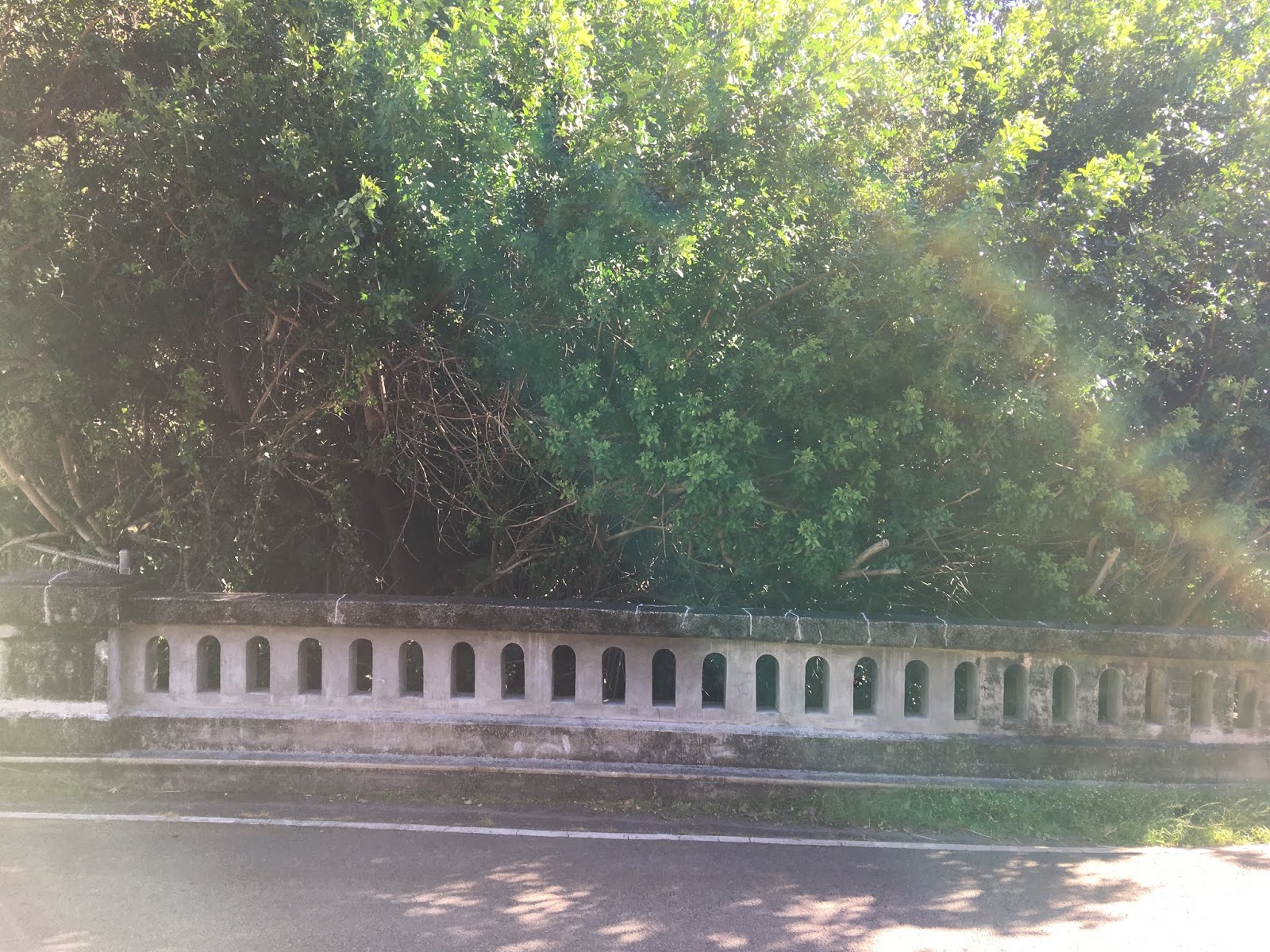
The waterways of Palolo Valley cover a large territory, and most of it is funneled by concrete design. But as it nears Manoa Stream, there is greenery. On the left, lush vegetation as it merges with Manoa. At right, a basic ditch. There probably isn't a more extreme difference on one side of a bridge to another.


Below, a hiking video by Howzitboy into Kaau Crater. Along the ridge, I had no idea there is a waterfall, let alone three, that feed Wai‘oma‘o Stream. I doubt I'll ever make this hike. It's very steep, lot of rock and cliff climbing, for elite hikers only. But the videos are amazing.


Comments