
Waihi Stream at Wa’aloa Way
When I resumed the #dailywalk, it was just a matter of time before I took photos of bridges and streams. It really triggered when I began to walk over McCully Street, Kalakaua Ave and Ala Moana Blvd. during this COVID-19 pandemic.
The bridges have distinct designs. Most are basic. Some are different. Even a bit stylish. Many, not all, have the origin date of construction written on them. My search for the name of the stream that flows next to Marco Polo condiminium led me to various flood-control reports and information. That got me thinking about the Ala Wai Watershed, and the importance of the source streams at the foot of the Koolaus.
None in this district is more important, say the US Army Corps of Engineers, than Manoa Stream. From what I've read, the construction of basins up and down the valleys to the Ala Wai Canal in the plan are many. Resistance from residents in the back of Palolo Valley has led to changes in the plan. But the basin in the back of Manoa Valley remains. Waihi Stream, which connects to Lua‘alaea Stream, is at the pinnacle of the discussion. I trekked back there a few days ago before I did any reading about flood control and source waterways. I just wanted to go as far as possible to see streams and bridges.
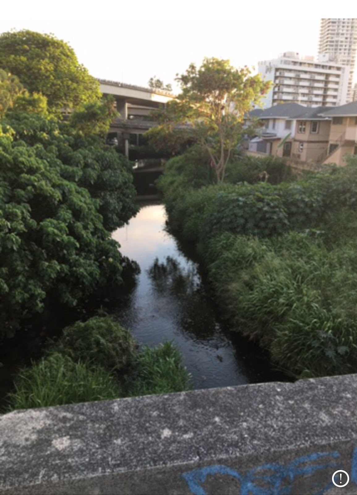
It's been a very interesting journey, though I'm not walking to the destinations like Waihi Stream or Palolo's Pukele Stream like I really should. That's for another time. Waihi is a stream I had never heard of until this week. It is narrow, calm and modestly beautiful. When the torrential rains of 2006 and 2015 struck Oahu, Waihi was one of many streams that overflowed with thunderous power. Looking at these photos now, it's hard to imagine that the water gushing through this path would be a huge reason for major flashfloods.


Of course, it originates much further up the mountain, and I don't know any paths to get up there, not legally. But here at Wa‘aloa Way and Wa‘akaua Street, there is a peace and natural ambience that is common the mountainside regions of many island valleys.


There is no bridge I know of that covers Lua‘alaea Stream, which meets Waihi Stream a short distance away, roughly one block. From there, Manoa Stream slices through the valley. Under Pawaina Street, Manoa Stream is still natural. Lots of ducks love the stream.


Depending on which map you see, from here it eventually becomes two separate waterways as one stream, and it continues to be a "double" stream as it nears Manoa Marketplace.


At this point, the design is clearly intended to direct the waters safely, and the construction is 100-percent man-made. My guess is the design was drawn over or along side the natural stream. The 1881 map I viewed shows that the major streams that wound up in the Ala Wai/Waikiki Watershed flowed eastward before entering the ocean — never a direct line north to south.
That's why the feasability study refers to the stream as "Woodlawn Ditch" when it rolls under Woodlawn Drive right above Longs Drugs store. However, from there, the waterway reverts back to natural environment. I walked along the banks of the stream a year ago and there was zero concrete.


The stream then bends south and flows east of the East-West Center at the University of Hawaii, under the Dole Street bridge — a good 30 feet or so below. It continues southward past the UH dorms, separating them from Kanewai Field — home to natural springs a century ago. There is plenty of tree covering, and the stream mostly free from human damage from Woodland to Old Waialae Road.


Added 9/15/20


For now, the ditches and Manoa-Palolo Drainage Canal get the job done. The dredging of the Ala Wai Canal continues, required every so many years and costing the public hundreds of millions of dollars. They had a viable solution back in the day when the watershed provided food for tens and hundreds of thousands of people. Times have changed, and maybe the solution has not.
There is middle ground. Maybe the construction of 10 to 20 waterways into and through the golf course would add some beauty while providing much-needed outlets when — not if — the Big Flood happens.
Make it so. Win-win for all.


Update 4/25/20
Beyond the old Paradise Park and Manoa Falls, Waihi Stream courses deep and splits off to ‘Aihualama Stream. A dirt (?) road leads to at least one more bridge, over ‘Aihualama Stream, maybe. Waihi Stream, up the mountain, is joined by another stream, one that has no name on my map. Can't be, right?


Comments