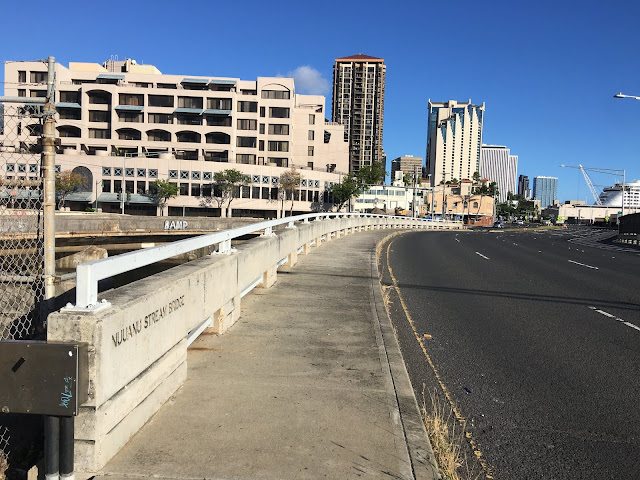
There are many streams and springs and waterfalls — and legends — across the Hawaiian Islands.
Not many are as vast and fun as Nuuanu. I'll tack on more photos and videos as I trek into more trails. On this first dip, I stuck to the simple access spots. That made it a fun afternoon that I won't forget. Even made a few new friends along the way.
I've only begin to scratch the surface in Nu‘uanu. I may never reach the pinnacle peaks or venture into the rough forays at 2,000 feet in elevation. But the valley and mountainside are a book into itself.
A comprehensive, entertaining history of the reservoirs is here.
http://www.ascehawaii.org/2006.html
Reservoir No. 4 via Lulumahu Stream.
Updated 6/21/20


Approaching Reservoir No. 4
An amazing history here with the dam, long defunct, and the water that once was piped into town for residents.
Nu‘uanu Valley is home to many legends. The one that sticks out is about five kupua dogs at Kapena (King's) Falls that warned travellers about troublemakers deep in the valley at the Pali. One listened to the dogs and returned to Waikiki. The other did not. Bandits killed the traveller at Pali, which led the chief to send out a party to locate and terminate the criminals.


This spot has been open occasionally, once a year, to fishing. Only 120 allowed out of a list of 1,000-plus. I didn't get close enough to notice any fish, but the place used to get re-stocked after dredging work.
A few years back, a young man died here after diving off the tower. Sad.


Reservoir No. 3
This is fed by Makuku Stream. Sorry, no pics of Makuku. Next time, yes.
This reminds me of the hand-built structure and piping at Kunawai Springs.
Updated 6/21/20
Adds additional photos from a second walk to the ewa side. This time I located the stream — mostly shallow and muddy — that connects Reservoir No. 2 to Nu‘uanu Stream.
Back at the entrance on the east side of No. 3
Makuku Stream above Reservoir No. 3 is nowhere to be seen. Probably dry until heavy rains. The ditch in front of the structure, however, is kinda cool. I followed it to the mauka side of the grassy area, and there's either a spring there, or it originates from further mauka. Lots of little ditches like this around Oahu. No names, but they get the job done.
It was silent until I got real close here. Then I could hear the trickling.
Reservoir No. 2 (Judd Trail)
No. 3 (Makuku Stream) feeds into No. 2, which is also fed by Mo‘ole Stream, which originates on the west side of the valley. No. 2's site is popular; across the road, the Judd Trail begins and cars are parked at roadside every day as hikers and nature lovers amble their way in to Jackass Ginger pool.I passed on the trail. Staying by the reservoir and watching ducks was all I needed. This was my first trip here. I'll get some footage of Mo‘ole and Makuku streams next time.
Every local bridge that has these arched pukas was built in the 1930s, from what I've seen.
Nu‘uanu Pali roadside
Kimo Dr. bridge
Pelekane Dr. bridge

Pu‘iwa Rd. bridge
La’imi Rd. bridge
Moanawai Pl. bridge
Kapena Falls/Alapena Pool
Also known as King's Falls, royalty of yesteryear luxuriated here. Today, however, it is borderline toxic and a haven to potentially lethal bacteria. Entering the water is not recommended. Diving off the cliff is also fraught with risk. People have died here.


The petroglyphs are behind a cage for protection, and I didn't get a good view this time, not knowing what to look for. The legend of Kapua, the guardian angel (supernatural?) dogs that protected a husband and wife, and their friends, would explain the dog and human petroglyphs. Next time. All I got are video and photos of the falls and pool and stream. Yes, this spot has way more opala than most trails, but it's no surprise being so far into town. More people, more rubbish. There have been tragedies here from accidental deaths and bacterial infections.
I still enjoyed the stream and its splendor. Won't ever go in.
Legend of Kupua http://www.pacificworlds.com/nuuanu/stories/story1.cfm
Nu’uanu Ave. bridge

N. Kuakini St. bridge

Interesting 'fence'
Lilioukalani Botanical Garden
Nu’uanu Stream merges into Waolani Stream. Waolani is stagnant sometimes while Nu‘uanu is active. In 1800s maps, the stream was still called Nu‘uanu all the way to the ocean. So why is it called Waolani after the merge? Or is that just a Google error?
Also, what is this underground ditch/tunnel that empties into Waolani/Nu‘uanu Stream makai of the N. Kuakini St. bridge? I called the botanical park office, and no one there knows. This ditch is more than just a minor
pipe emptying into a stream, but it remains
unmapped from what I've seen.
N. Vineyard Blvd. bridge

Entering Chinatown, Nu’uanu Stream absorbs Pauoa Stream. Pauoa emerges from underground level below Kukui St.
Next, the bridges of Beretania St., Hotel St., King St., Nimitx Hwy.
Nimitz Hwy. bridge


Comments