
Though it's the dead of summer, streams are bone dry and each valley appears to be fairly similar on a street map, there's more. The little ditches. Especially at Kuli‘ou‘ou Valley.
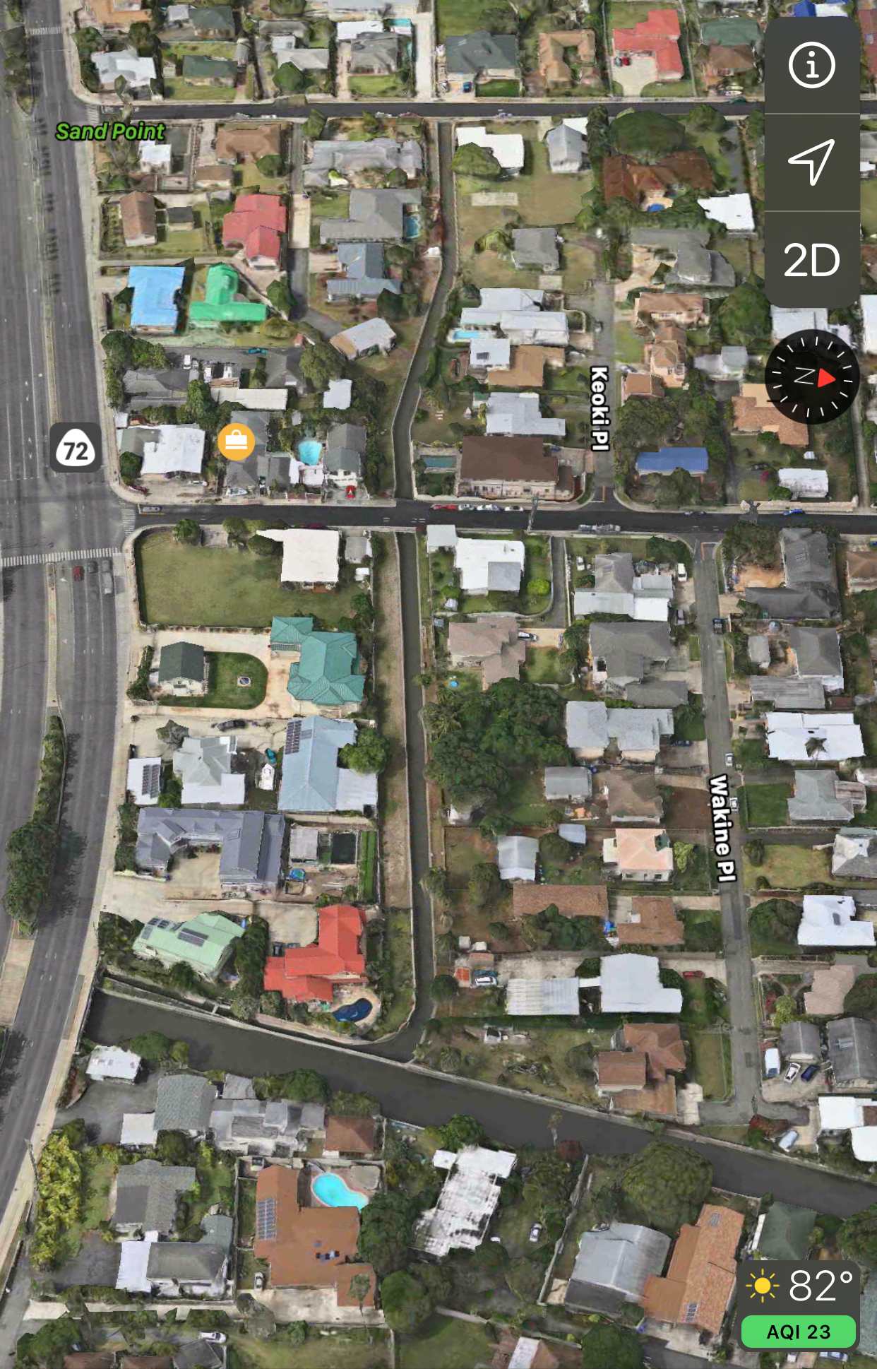
On the ewa side, there are almost a handful. The longer slope makes ditches practical when those heavy rainfalls come, and the most recent one in 2018 did significant damage. It just wasn't on the ewa side. On the east side, where homes are built right into the foot of the hill, there was damage on Wakine Place next to Kuli‘ou‘ou Stream.
From the basin at the top of Kuli‘ou‘ou Road to the ocean, the concrete channel is quite clear with a minimum of vegetation. It's as open as any stream I've seen this year. At the site of the 2018 flood, the stream is wall-to-wall water, but that's from the nearby mouth located below Kalanianaole Highway and Summer Street.
It also contains some rainfall from awhile back that hasn't evaporated and has sat there as sand does its natural thing and creates a block at the mouth. I saw this at the mouth of Muliwai Stream/Ditch and other places. There is also a west-to-east canal in Kuli‘ou‘ou that joins the stream. It begins a block from one of the Board of Water Supply stations on the highway. No feeder. Just a wall at Eleupe Road. No fish. No excess foliage. Just water, though not completely stagnant.
The basin area is a different look. Quite overgrown, but no trash. The valley runs deep and high, more than some other East Honolulu valleys. The capacity for dangerous conditions doesn't require a lot of imagination here. That's why those ditches on the ewa side are so interesting when I zoom into a satellite map. Most of them are really unaccessible in the thick of shrubs and trees, but they do pop up in between houses to drain into system underground. I've never noticed this many ditches in a valley until now. The ones that I saw are relatively clear.
Kuli‘ou‘ou basin


Kuli‘ou‘ou Rd. (facing mauka)


Kuli‘ou‘ou Rd. (facing makai)


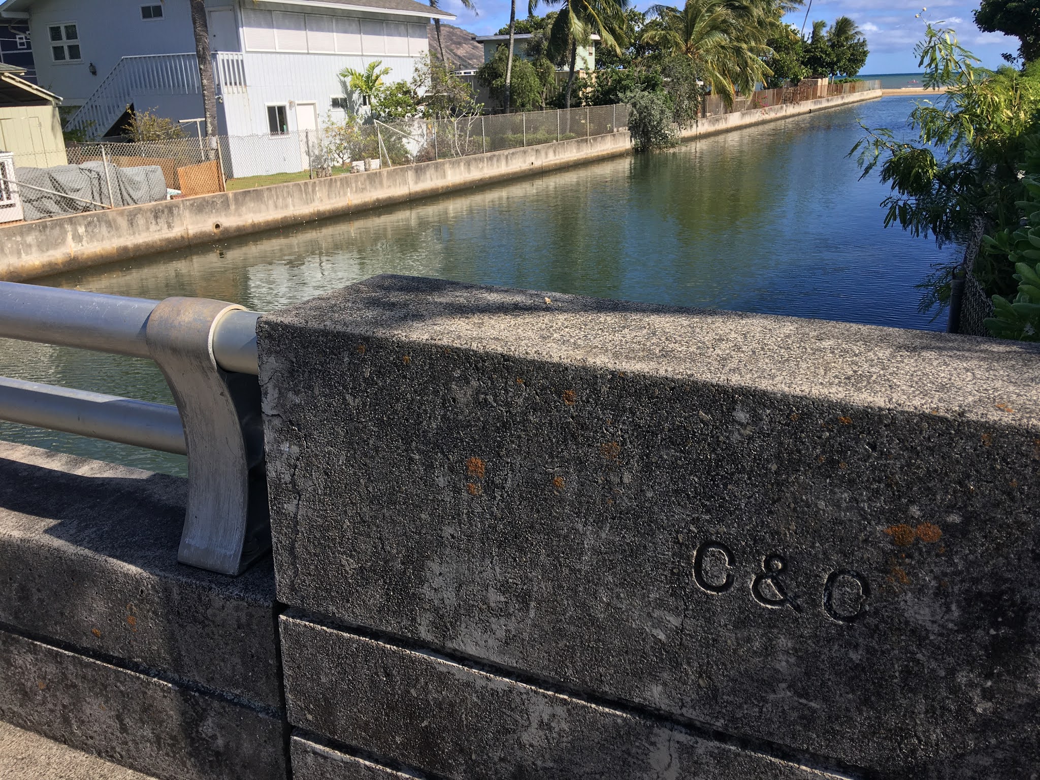
Didn't notice the trash until I looked at the photo later. Much as I prefer traditional bridge railings, this is evidence that fences have multiple positive factors. They also keep pets and small children from falling in.
I had photos at the white bridge overlooking the park, but deleted them by accident with a bunch of valley pics from my first day in Kuli‘ou‘ou. I still have video, though. From the bridge, a wide "off ramp" from the park — between the basketball court and a BWS station — opens into Kuli‘ou‘ou Stream. That off-ramp is wide enough to drive a truck through. I believe the runoff from some of the ewa-side ditches ends up here, or close by.
Haleloa Pl.
This bridge is dated 1973. Possibly, there were no residences on the east side of the stream until then. Or this was a replacement for a previous bridge. The buildings sit right at the foot of the ridge, what developers call "infill." What my geology professors said is a bit risky given Hawaii's constant erosion.


Kawekiu Pl.


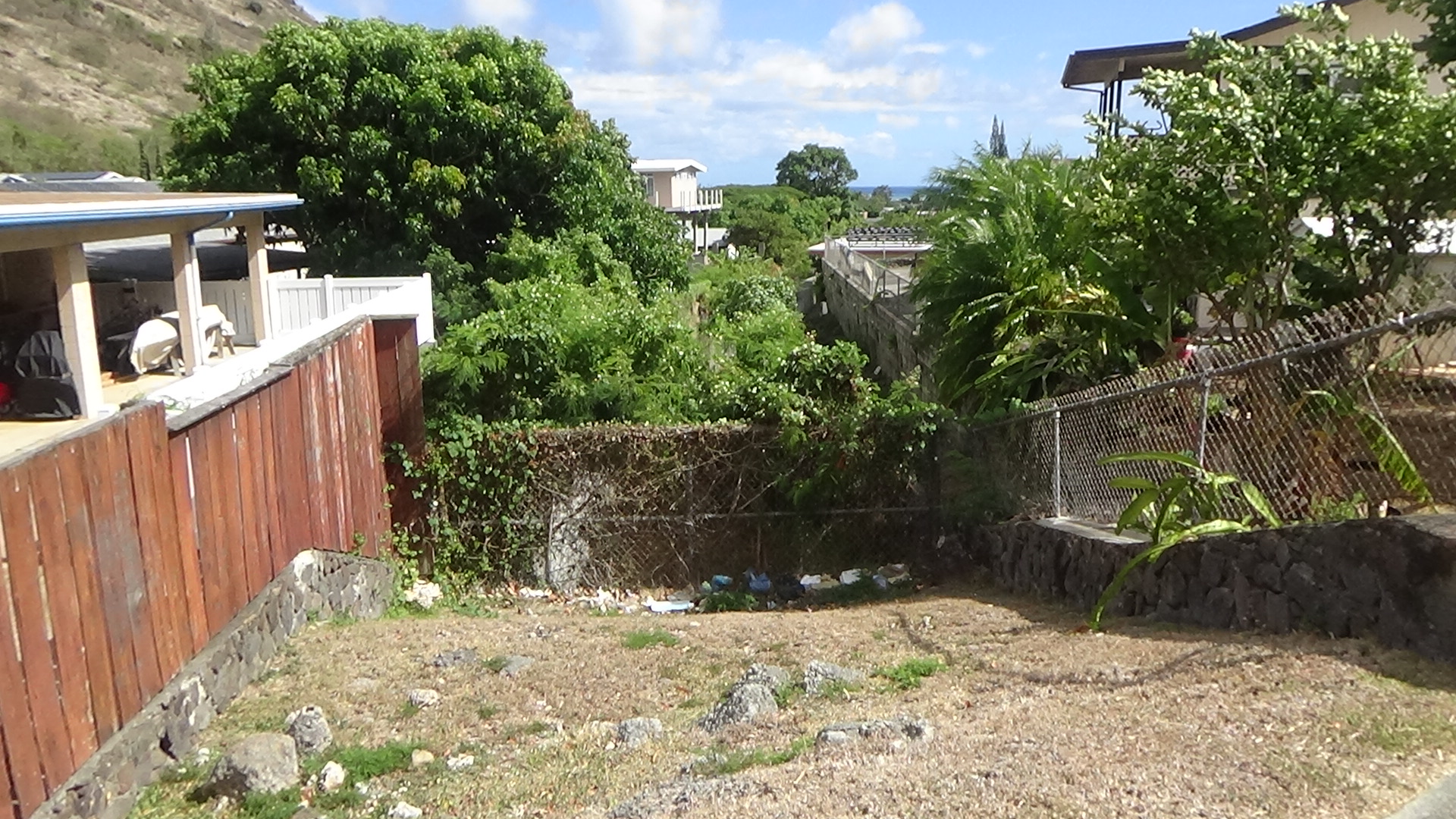
Wakine Pl.
The resident at the makai side of the street was outside and we talked story about the flood. He was nice enough to let me stand on the property and take pics and video from the wall. It has been a slightly wet summer, but really hot and dry in the past month or so. The stream is wet here as we get close to the ocean. Any kind of serious rainfall, imagine the impact. Good thing the stream is well maintained at this point.


Kalanianaole Hwy.


Kalanianaole Hwy. (makai view)


Summer St. (facing makai)
The mouth of Kuli‘ou‘ou Stream is visible from here. No access to the mouth via beach, so this is as close as I can get for now.


Heading to the ewa ditches of Kuli‘ou‘ou Valley. Quite a sight from the shoreline.

From here, I bounced up and down the ewa side of the valley. I'd seen a few ditches on the satellite map earlier, but while I was on this trek, I looked closer and found more. They're so essential, yet so small that anyone can drive past one without noticing a thing.
Here's one on the upper part of the ewa side.
Ka‘eleloi Pl.
This road is north-south and the ditch on the hill side is parallel. Easy to miss. It actually rolls downhill, and also wraps around surrounding homes in the back. The drainage happens when the ditch dips to the side of a house. Grill is right there. Very unique design — and very practical on those flashflood-watch type days and nights. This dry hill and the ditch seem docile now, but when it pours, the drainage is a huge help to the homes across the street.


A short walk downhill is where the two points of the ditch meet and drain under the street. My guess is the drainage system leads to Kuli‘ou‘ou Stream a few blocks southeast, in the BWS station area.


The incline on the side of this house at Ka‘eleloi Pl. is steep. Maybe 35 degrees. I like how these ditch walls are all around 2-3 feet tall.
A second ditch on this same road is tucked in-between two homes. I actually missed it completely until around 30 minutes later while looking at the satellite map.


Down the road, there are two narrow ditches that originate way over by the ridge. They both end up going into gutters under Kuli‘ou‘ou Rd. across the street from the park and BWS station. One was right there in plain view. The other is hidden behind a nicely painted wooden fence.
Ditches at Kuli‘ou‘ou Rd.


The hidden ditch. Very clean and nice. Just a block or so makai from the first one on Kuli‘ou‘ou Rd.


A look at this crease on the side of the ridge. That is basically a funnel. This is labeled Kuli‘ou‘ou Ridge 2; Ridge 1 is on the east side of the valley. But within Ridge 2, there is this crease that is almost a gulch, leading right to Papahehi Pl.


The vast acreage up on the slopes of Papahehi Pl. is thick and covered with trees and weeds. Getting behind there to another ditch would be require permission and I might try another time. For now, the satellite map shows a lot. When these long ditches were installed, they had to cut through a lot, probably after a rainy season that did some damage to homes. Even if I'd gotten to the ditches, if they're extremely V-shaped like the ones on Kuli‘ou‘ou Rd., that's a royal pain to walk on. But it gets the job done for the people on this side of the valley.
Papahehi means "flat" according to one translation. But the second translation I found is more fitting: n. Footboard, used for dancing; treadle. Lit., board to step on. This is from the Pukui-Elbert dictionary, which I always trust most. Was this a slope to ride boards and sled on — like Holualoa on Hawaii Island?


Finally, the canal near Kalanianaole Hwy at Eleupe St. No trash.


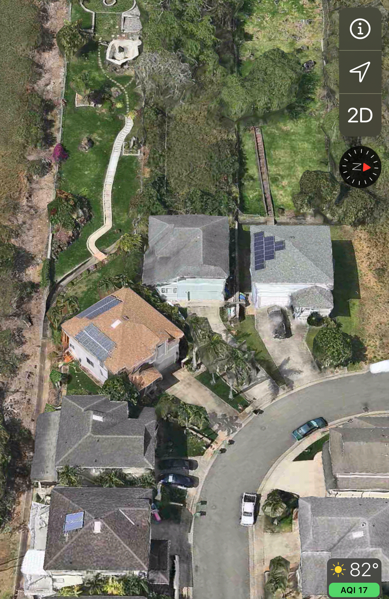
Below, a look at one of the backyards on the west side. The space at right is green and the surrounding area is basically dry and almost brown. That pathway looks like a stairway. Is this a picnic area that is watered consistently? Nice.
And, finally, I'm adding these photos a few days late. Almost forgot about Paiko Lagoon. Read about this spot. It is named after Manuel de Pico, a Portuguese whaler who settled in Hawaii. He bought this area for $800 after the Great Mahele, according to Maunalua.net.
http://www.maunalua.net/paiko.html


Comments