Boulder City. Whether it is Ka‘alakei Valley, next door to the left, or Hahaione Valley, I haven't seen this many boulders on Oahu.
A little tremor and those big rocks easily go tumbling downhill. So I kept my time around these ancient creations brief.
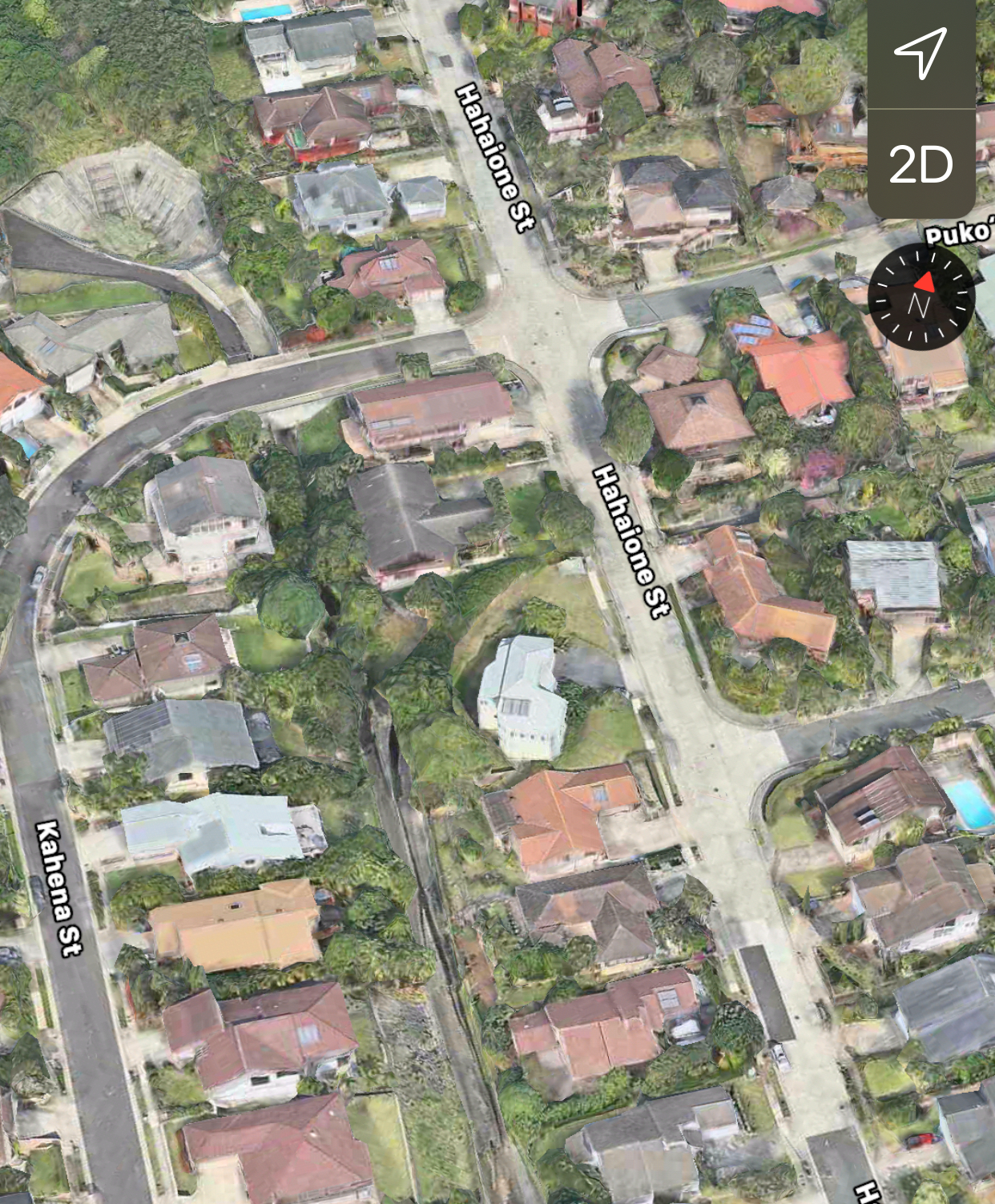
Hahaione translates to "sand broken." Ulukau.org offers no other explanation. My take is that though the valley appears long and filled with residential properties, in the ancient days, there was not much filled in and most of area was actually shoreline with Kuapa Pond as its partner. Or not. Just a guess.
Also: Mauna‘oahi Ridge, which stands between Ka‘alakei and Hahaione, is translated to "fire-hurling hill." Say what? My first thought is that during ancient battles, this was the spot to heave fireballs from. Or cannon balls. Both. Also, Ulukau spells this Mauna o Ahi Ridge. The topographic map goes back a long time, but only to the era when each valley had a district park. The 1925 map of Wailupe that I found online yesterday had more information than the topographic, which is still a huge vault of information.
On the east of Hahaione Valley, Kaluanui Ridge was known as "the big pit." It is known today as Mariner's Ridge. I just want to know what the big pit was about. Kalua? As in pig?
At this point, I haven't visited the east basin of Hahaione yet. Didn't know about it until after the first leg. And there are some ditches on the ewa side that are interesting.
Video footage shows a spooky torrent in 2012, and then a flood in 2018.
2012: https://youtu.be/3tFjMRRCf28
2018: https://youtu.be/nMPwBexg-vY
Unlike Kaalakei Valley to the ewa side, Hahaione Valley has residences almost right up to the Koolau Mountain Range. And the dropoff of Mauna‘oahi Ridge is quite steep. That explains, in part, the damage caused by the 2018 flood that hit Hahaione, Ka‘alakei and Kuli‘ouou.
Might be the deepest basin I've seen in Honolulu. And it was filled during the '18 flood. But all I saw was on a map. This is the closest I could get to it. Unlike other East Honolulu basins, this entrance area is locked up. My guess is that the basin is so deep, the level of danger is too high, and they take no risks.
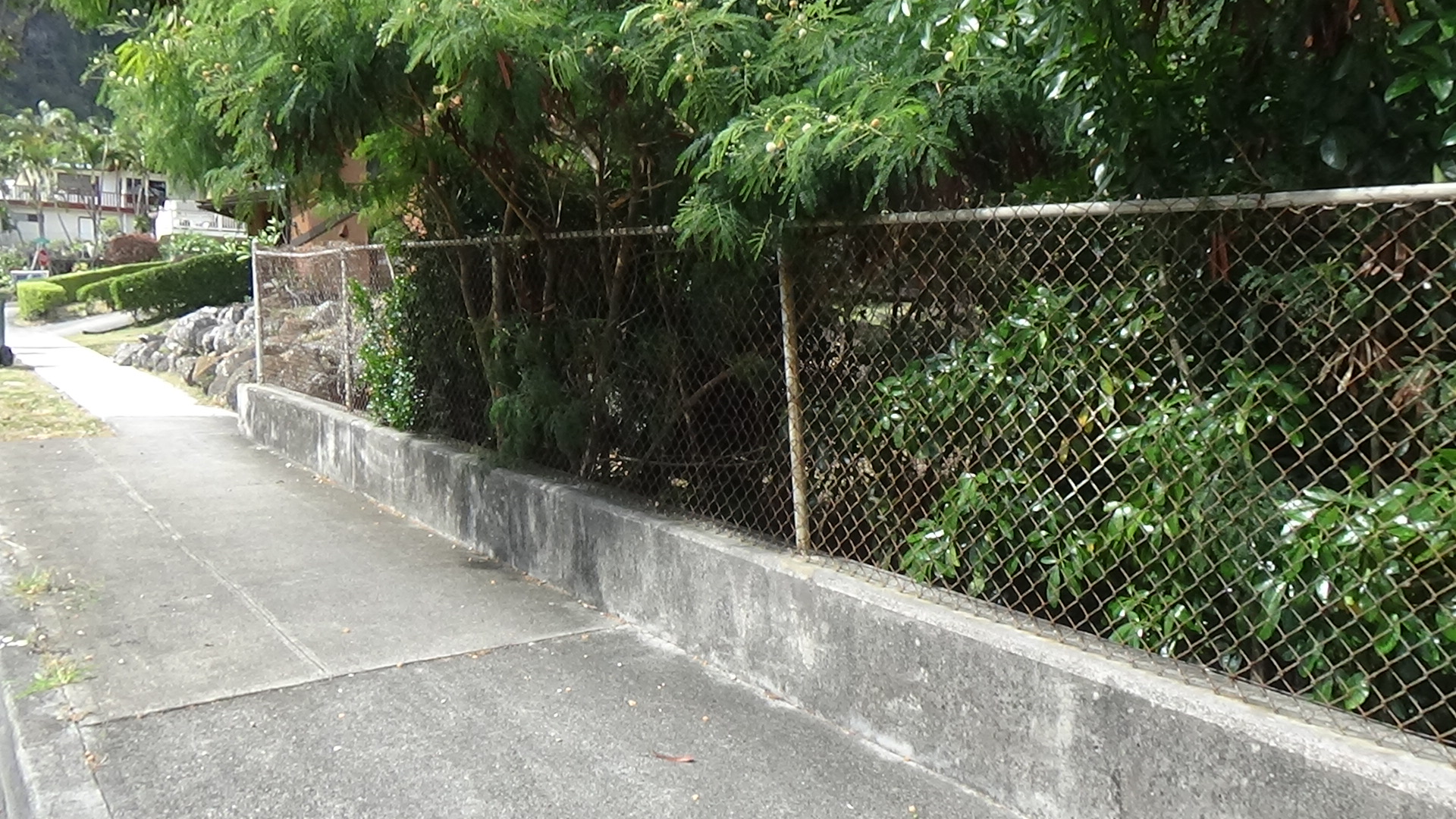
East-west ditches where the residential zone meets the forest.
It wasn't until I was done with photos on the first day that I looked closer at the satellite map and realized there is a second basin on the northeast side. The topographical map has no specific name for each stream. My guess is the northwest stream is Hahaione and the northeast stream is Kaluanui, the same as the adjacent ridge.
Mauka view
Here's a look at the northeast basin area and the stream going westward under Hahaione Street. This is south of Puko‘o Street and north of Uwao St. One of the neighbors told me that the overgrowth behind his house in the channel was worrisome and he planned to call the City and County. From what I've read, it was overgrowth that has been a serious problem at this basin or the northwest Hahaione basin in recent years. There's a lot of overgrowth at the northeast basin area, but in the actual basin, it appears to be OK. Tough view since it's fenced off.
Here's the northeast stream at the east side of Hahaione Street.
On the ewa side of Hahaione Street, no view. The view is shrouded by bushes.
Ainapo St.
At this spot, the bridge reads "Hahaione Channel."
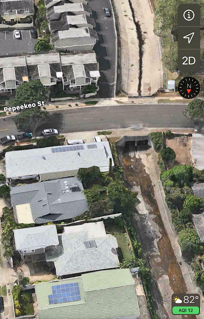
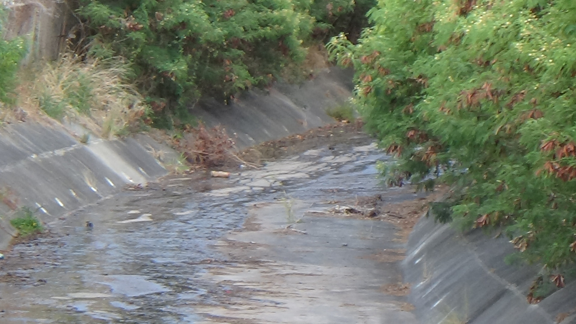
Pepeekeo St. (makai view)
Pepeekeo St. (mauka view)
Nice work at Hahaione Park.
Keahole St. near Costco
Interesting. Nice view of all the homes with their boats, kayaks and even paddle boards.
The sidewalk on the mauka side of this bridge is 2 feet wide.
This little guy was just chilling. The massive colony of cats is a few blocks away, but he seems quite content on his own under the bridge. A lot of the cats in this area, even Ka‘alakei, have this same black-and-white pattern on their heads. Same facial type, too. One of my neighbors is a cat lover and told me that a lot of the white and black cats on the island originated from a small colony on the UH-Manoa campus.
Here's the exit at Koko Marina area.
Here's the makai side of the bridge (Kalanianaole Hwy.).
The coast area was considered Hahaione, too. Here’s what Ulukau.org says: “The plain below Kamiloiki and Kealakipapa was known as Ke-kula-o-Kamau[u]wai. This was the famous potato-planting place from which came the potatoes traded to ships that anchored off Hahaione in whaling days." (Handy)
Known also as Mauuwai Valley, located East, mauka from Hawaii Kai Golf Course. I wonder if there are still sweet potatoes growing there. Of course, one of those whalers was a man named Pico, who jumped ship and eventually purchased the land that is known now as Paiko Lagoon near Wailupe and Kuli’ou’ou. That would be a heck of a time machine interview.
It's been almost three weeks since I was at the northeast basin and the marina bridge. I wanted to get photos of the Hahaione Valley ditches, but that'll be another time. Without these well-placed ditches, many of the valleys in East Honolulu would have much more severe problems in times of flashflood-level downpours.


Comments